Shoukun Sun

Projects

Research directions first, then the tools and platforms other groups run day to day.

Research

Interactive segmentation with fewer clicks

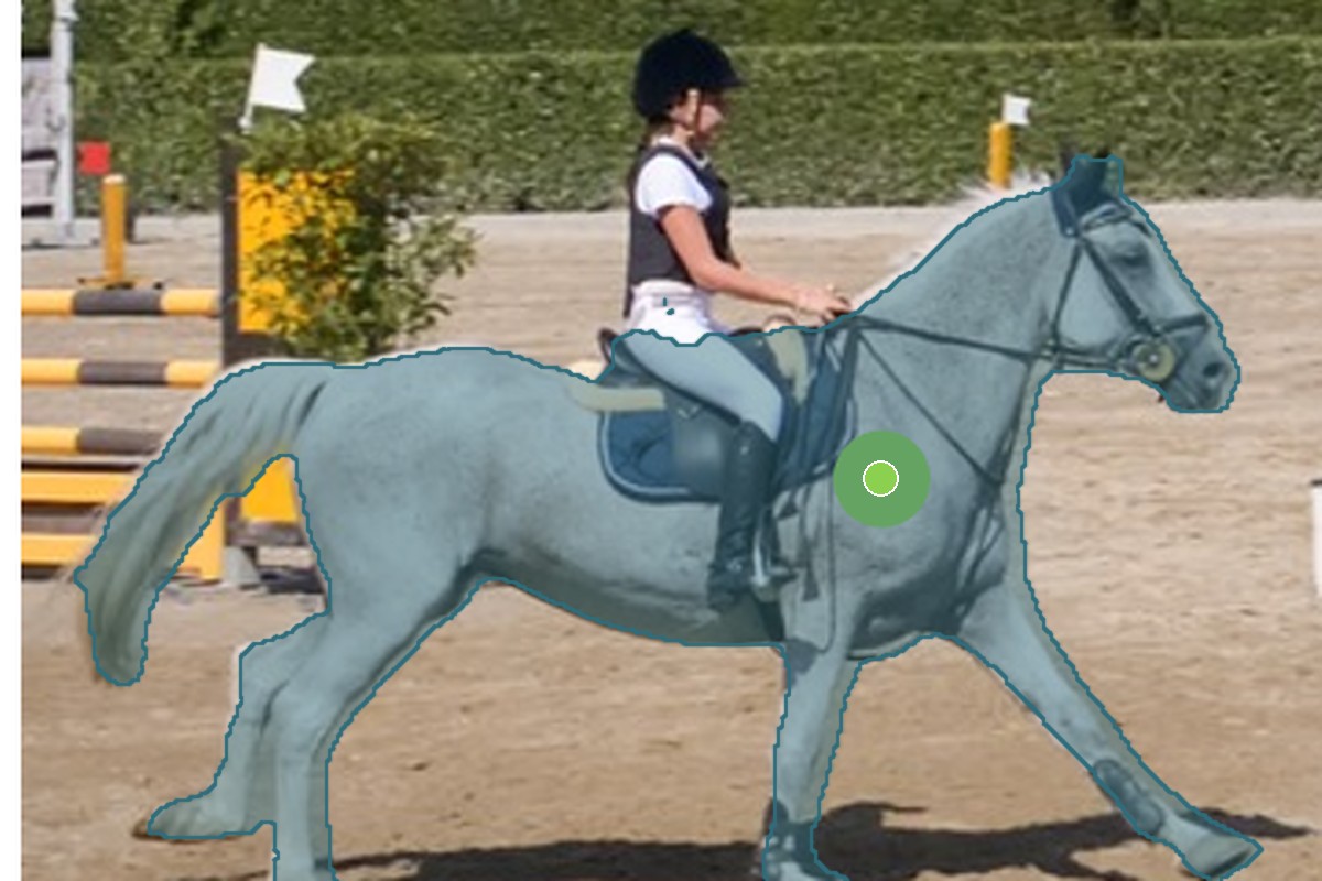
CFR-ICL trains an interactive segmentation model with an iterative click loss, the first loss to put the number of user clicks into the training objective, and refines masks at inference by running the same network over its own output. It set the state of the art on five benchmarks and needs 33% fewer clicks than the previous best to reach 0.95 IoU on Berkeley. It has since become the annotation engine behind our TRISO nuclear-fuel datasets.
Diffusion models beyond their native resolution

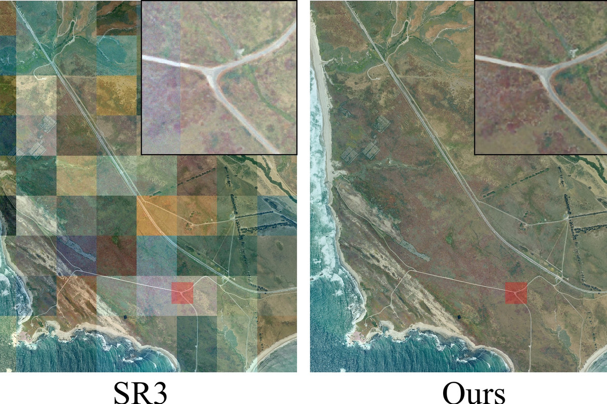
Averaging overlapping patches lets a small diffusion model paint a large image, but it quietly erodes the noise the sampler depends on, leaving seams and blur. Guided and variance-corrected fusion repairs this at no extra cost, taking a 512-pixel text-to-image model to seamless panoramas seven times wider and lowering FID from 11.19 to 4.02. InfScene-SR carries the same correction into super-resolution of arbitrarily large satellite scenes at constant GPU memory, within 0.003 IoU of native high-resolution imagery on a downstream mapping task.

Satellite image co-registration that does not fail silently

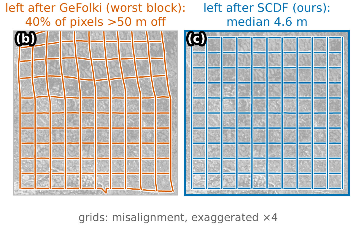
Alignment tools each assume one kind of motion and fail silently on the image pairs that break it. SCDF estimates a dense per-pixel displacement field with acceptance thresholds calibrated from the image pair itself: training-free, GPU-free, whole 8192-pixel scenes on one CPU core. On a new 584-pair benchmark over 60 sites worldwide it registers every pair without failure and lowers the best baseline's median error from 6.83 to 4.17 m.

Measuring fission-gas bubbles in irradiated nuclear fuel

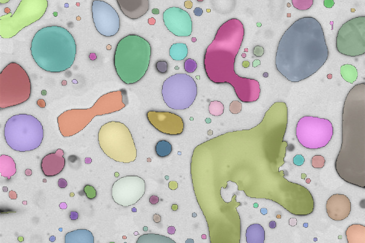
With Idaho National Laboratory: a multitask network that separates touching fission-gas bubbles in electron micrographs of irradiated U-10Zr fuel, reaching 92% instance recall from only 827 annotated bubbles, against 54% for the thresholding it replaced. The same model then measured about 230,000 pores across an entire 6 mm fuel cross section, and the collaboration continues on TRISO particle fuel with RU-Net and the uncertainty-aware UA-Net.

Cause and effect from nuclear event reports

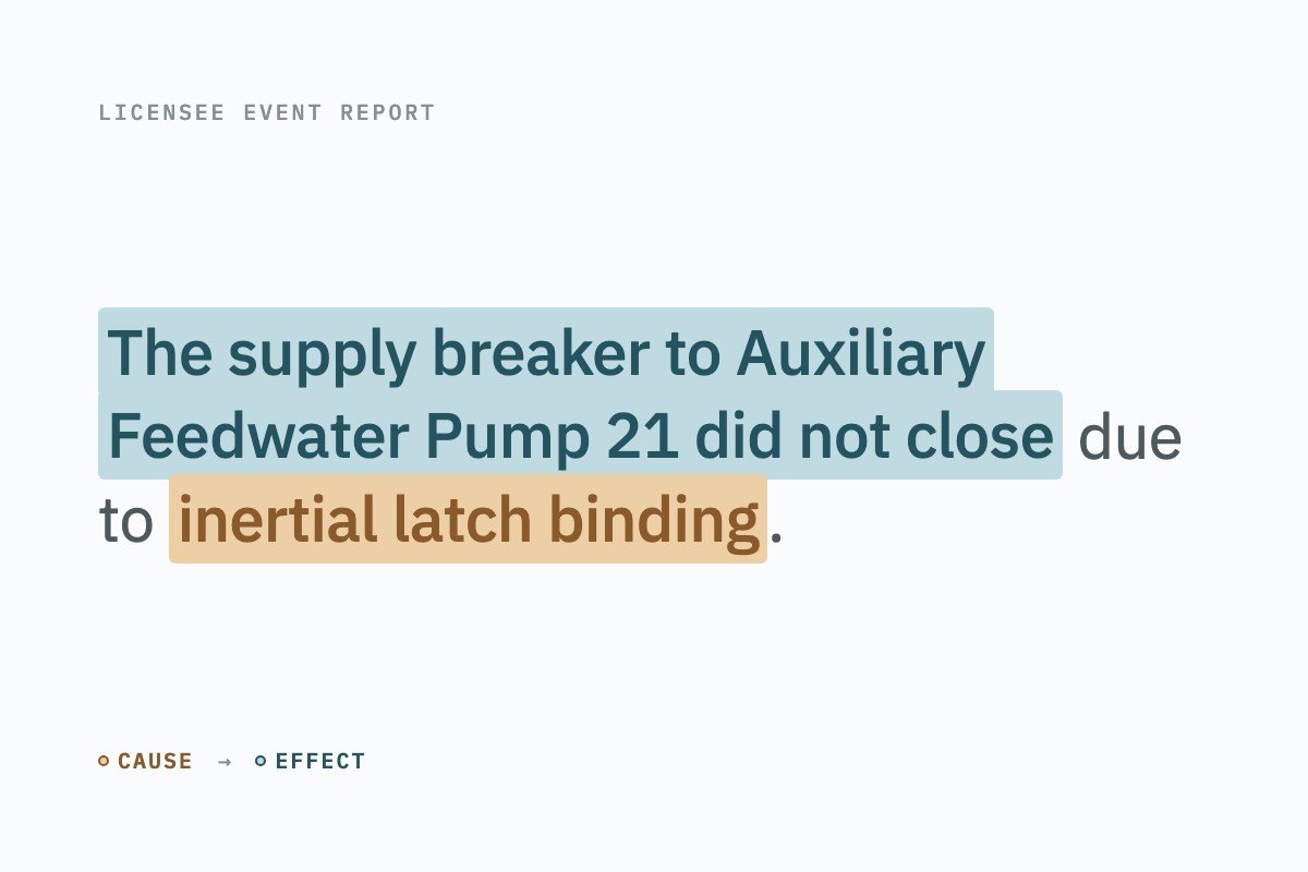
Every failure at a U.S. nuclear plant produces a free-text Licensee Event Report, and the causal chains inside those narratives had to be read out by hand. With INL we built the pipeline that turns them into data: PDF parsing, a web-based annotation tool, a CNN–BiLSTM classifier that finds causal passages at 99.1% test accuracy, and a rule stage that splits each passage into its cause and its effect. A follow-up replaces the rules with a fine-tuned language model for failure-event mining across plant reports.

Deep-learning species distribution models for the Gulf Coast

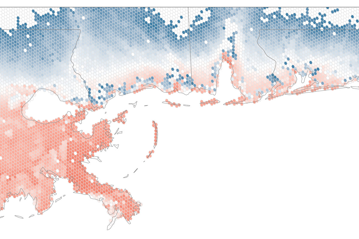
With ecologists at NCEAS (UC Santa Barbara): deep species-distribution models trained on ten years of eBird checklists for 332 bird species, which learn which species co-occur rather than fitting each one alone. Re-run over simulated post-hurricane landscapes, they map where habitat suitability rises and falls under moderate and intense warming. A companion study with a generative hurdle model finds that sea-level rise erodes birds' functional diversity not on the exposed shoreline but in the coastal transition zone just inland. The same partnership uses SegMap to map invasive iceplant along the California coast.

Robust breast-ultrasound classification

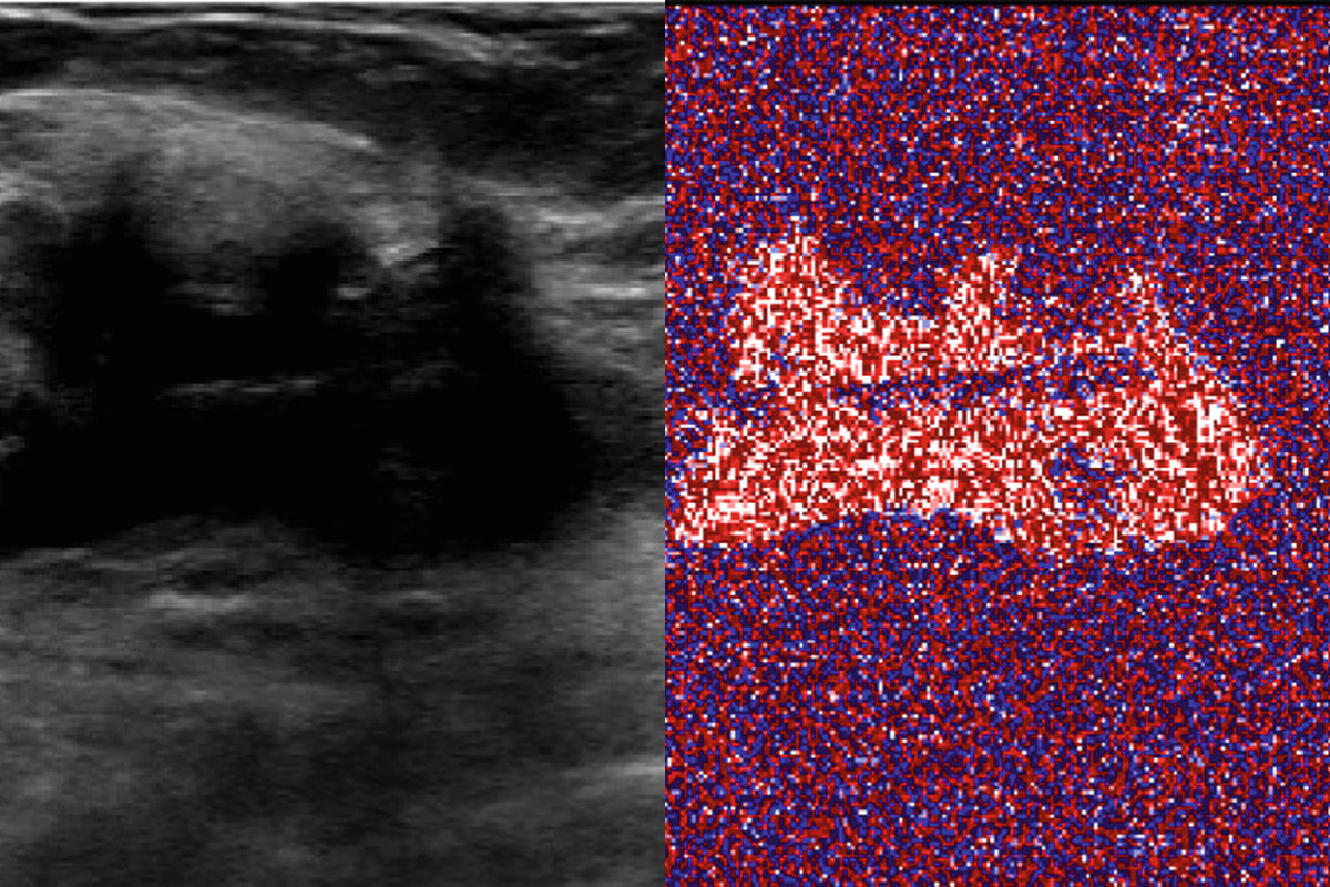
A perturbation too small to see can flip a network's reading of a breast-ultrasound image from malignant to benign, and standard adversarial defences, built for large natural-image datasets, do not hold up on the 1,190 images available here. MIRST-DM trains on the whole sequence of progressively attacked images rather than the worst one, and replaces the first max-pooling layer with a drop-max layer that discards the one activation an attacker manipulates. Against PGD and CW attacks that drive a plain ResNet-50 to an F1 of zero, it restores F1 to 0.59 and 0.73.

Software & platforms

Auto-IS

Auto-IS

General-purpose interactive image-annotation platform combining interactive segmentation, AI-assisted labeling, incremental model training, and group collaboration. Deployed and in routine research use at Idaho National Laboratory and the University of Idaho, reducing data preparation time by up to 90%.

SegMap

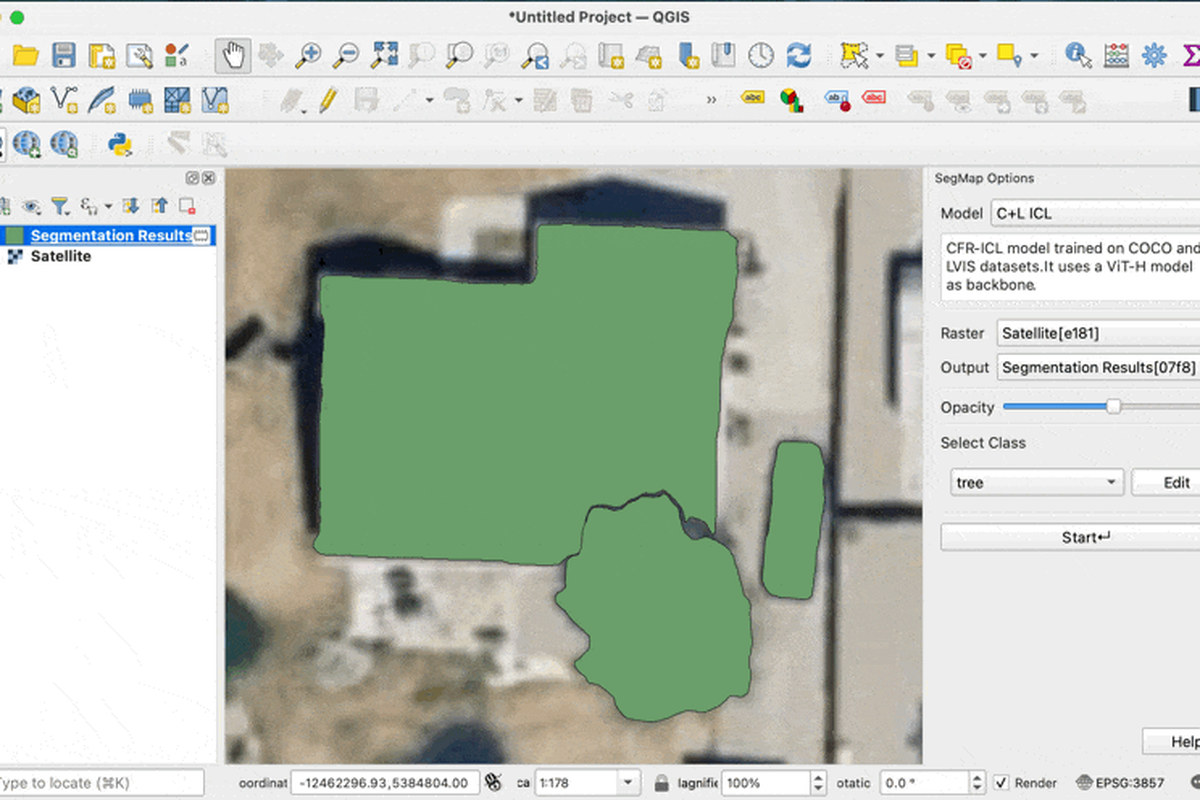
Interactive-segmentation tool for annotating remote-sensing imagery, available as both a QGIS plugin (3,900+ downloads) and a web application. In use at NCEAS (UC Santa Barbara) and The Nature Conservancy for ecological and conservation research, including invasive-species (iceplant) mapping.

Gkit

Gkit

Python library built on GDAL for processing geospatial rasters as NumPy masked arrays; 130K+ PyPI downloads.

Postdown

Postdown

Command-line tool that turns Postman collections into Markdown API docs; 78K+ PyPI downloads, 70+ GitHub stars.

CITIfile

CITIfile

Python parser that loads CITI-format RF measurement files (e.g., network-analyzer S-parameters) into xarray datasets; 40K+ PyPI downloads.

NLP Causality Extraction Labeling Platform

NLP Causality Extraction Labeling Platform

Labeling platform for marking cause-effect relations in multi-source documents (Python, Django, Vue.js), built for higher annotation throughput than general-purpose text-annotation tools.

Breast Cancer Labeling Platform

Breast Cancer Labeling Platform

Public web platform for annotating breast-cancer ultrasound images (Python, Django, JavaScript), supporting collaborative dataset creation for medical-imaging models.

mindat.org mobile application

mindat.org mobile application

The official mobile application of mindat.org, the world's largest open mineralogy database, giving geologists offline field access to mineral occurrence data. Currently in internal testing.